Community Crime Mapping
Welcome to the City of Mercer Island Police Department's Neighborhood Community Crime Mapping Website
The Mercer Island Police Department is pleased to announce an interactive neighborhood crime mapping program. Crime Mapping is a web-based program that was developed for the Police Department to provide the community with information about recent crime activity in their neighborhood. This service is provided internally through our GIS division and Mercer Island specific crime data is extracted from the Police Department’s records system, allowing citizens to view up to the last 6 months of crime data by various search parameters, to include a date range, crime type, or around a specific address. The data will be illustrated on a map and the various crimes will be depicted by various crime type icons, each containing general details of the incident. Community members will also be able to develop queries that can be shared and printed.
Notes on use:
When the map first loads, it will load all data from the past 6 months.
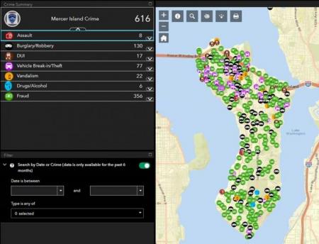
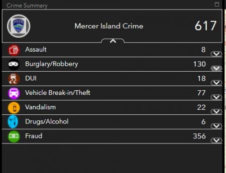
SUMMARY INFO section
The SUMMARY INFO does a COUNT of all the crime
You can expand each crime type in the Info Summary section and, select a crime and a pop-up will appear on the map with more information If you zoom into the map (using the +/- or by holding down the SHIFT key and drawing an area), the Info Summary section will re-do the counts for that area only
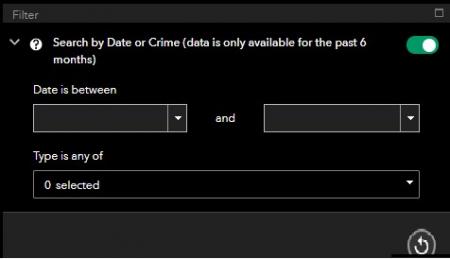
FILTER section on the bottom left of the map:
To narrow down the search, you can FILTER by date range in the bottom left or FILTER by Crime Type (or both).
A reset button resets the filters
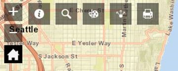
Other TOOLS on the top section of the map:
ABOUT- Gives a quick summary of the map information
SEARCH- Search by address
DRAW- Draw graphics on the map
SHARE- Share your map. The link preserves the map area and data
PRINT- Print your map in a variety of sizes in .pdf format
Enter Crime Mapping Now
Upcoming Events
-
08/06/2024 - 5:00pm
Contact Information
Police Department
9611 SE 36th Street
Mercer Island, WA 98040
Phone: (206) 275-7610
Email: mi-records@mercerisland.gov
In an Emergency, call 911
For our Non-Emergency 24/7 dispatch center, call: (425) 577-5656
Follow this link for the latest facility and program information.